Santa Fe (Santa Fe)
 |
About thirty years ago, Santa Fe was just one of the biggest barrios of Palo, Leyte. In 1948, Juan R. Perez, a native of this barrio, was a private secretary. Inspired and prompted by Melquiades Almen, Julian Dagami, Jose Catada, Antonio Evalo, Eulogio Navarra and Maximo Postreto, all civic leaders and with the consent of Mayor Generoso Alvarado of Palo, House Bill No. 1918 was drafted and sponsored on May 6, 1948, on the floor of the House of Representatives by Congressman Perez, creating Santa Fe a town. At first there was strong opposition from the residents of Palo as Santa Fe and other affected barrios were the main source of income for the town but the oppositionist were silenced by the budding leaders of Santa Fe. The bill was finally approved by the lower house and the Senate under the leadership of Senator Jose Avelino. However, politics intervened. While the bill was waiting for the signature of President Elpidio Quirino, there was a split of the party in power.
Although President Quirino was the logical candidate for election, many leaders believed that Senate President Jose Avelino was the apparent successor to the presidency. Don Pio Pedrosa, then Secretary of Finance in the Cabinet of President Quirino was commissioned to sound out the political sentiments of the people of Santa Fe in that presidential election. His objective in visiting Santa Fe was to unite the leaders there so that it would be easy for him to secure approval of the bill pending the signature of President Quirino converting Santa Fe into a town. Those supporting the administration met Sec. Pedrosa in the old Martinez residence. Atty. Carlos Martinez was the leader of this group. Those supporting Senate President Jose Avelino, under the leadership of the private secretary of Congressman Juan Perez met Sec. Pedrosa in the public victory in the entire country. The bill creating Santa Fe into a town was vetoed. However, the yearnings, dreams and aspirations of this ambitious barrio was not to be denied for long. Smarting from the bitter lesson of disunity, fresh efforts were exerted to renew the campaign with more enthusiasm to convince the powers that Santa Fe should be made a free and independent town from Palo, in the name of progress. At this point, the warring political factions of the town were strongly united and determined to overcome all obstacles along the way. Under the guidance of Santa Ana, the patroness of this barrio, Don Pio Pedrosa forgave those who did not follow him in that presidential election. Upon his strong recommendation, President Quirino, by Executive Order No. 277 dated October 10, 1949, created Santa Fe, together with Tunga and Julita as new towns of Leyte.
Santa Fe was then born as a free and independent town by presidential fiat and notably legislative action. On the eve of its traditional town fiesta, the residents under the leadership of Mayor Iluminado Martinez, one of the first councilors of Santa Fe in 1949 and dynamic parish priest Rev. Father Antonio Adre, in grateful remembrance and recognition, saluted the efforts of those who led in making Santa Fe a town out of several barrios of Palo. Its fertile fields and valleys abound with corn, camote and other root crops, while its rivers Kasili-on and Maslog are rich with fish, adequate in quantity to give food and sustenance to its ever-increasing population. The BANCOM projects in its northern periphery promises to be the rice granary of the town. Today there are 15 barangays in Santa Fe with an area of 5,567 hectares irrigated and planted with rice.
Map - Santa Fe (Santa Fe)
Map
Country - Philippines
 |
 |
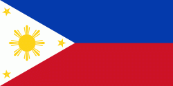
| Flag of the Philippines | |
Negritos, some of the archipelago's earliest inhabitants, were followed by successive waves of Austronesian peoples. Adoption of animism, Hinduism and Islam established island-kingdoms called Kedatuan, Rajahnates, and Sultanates. The arrival of Ferdinand Magellan, a Portuguese explorer leading a fleet for Spain, marked the beginning of Spanish colonization. In 1543, Spanish explorer Ruy López de Villalobos named the archipelago Las Islas Filipinas in honor of Philip II of Spain. Spanish settlement through Mexico, beginning in 1565, led to the Philippines becoming ruled by the Spanish Empire for more than 300 years. During this time, Catholicism became the dominant religion, and Manila became the western hub of trans-Pacific trade. In 1896, the Philippine Revolution began, which then became entwined with the 1898 Spanish–American War. Spain ceded the territory to the United States, while Filipino revolutionaries declared the First Philippine Republic. The ensuing Philippine–American War ended with the United States establishing control over the territory, which they maintained until the Japanese invasion of the islands during World War II. Following liberation, the Philippines became independent in 1946. Since then, the unitary sovereign state has often had a tumultuous experience with democracy, which included the overthrow of a decades-long dictatorship by a nonviolent revolution.
Currency / Language
| ISO | Currency | Symbol | Significant figures |
|---|---|---|---|
| PHP | Philippine peso | ₱ | 2 |
| ISO | Language |
|---|---|
| EN | English language |
| TL | Tagalog language |


